 Skip to content


Tool Shed
Toolbox
$745.00
Tools for System Management, Data Export and Specialist Workflows
1 Year Subscription for Single User access to RPS Tool Shed Toolbox for Trimble Business Center Software
Primary Commands

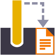
Corridor As Built Report
Creates a formatted Excel Spreadsheet report from measured 3D points aligned to specified station intervals against a line or alignment, sorted from Left to Right across the alignment where each column of data is a specified code and the value presented is the Delta Elevation between the measured point and the referenced surface elevation.
Corridor Cut Sheet Report
Generates a Cut Sheet Report for Project Supervisors that shows full cross section details of slope, elevation, offset, delta elevation and cut/fill for user selected nodes of a corridor cross section material layer surface e.g. Finished Grade. The report generates a section at every defined interval plus all critical locations (PC, PT, VPI etc.) as well as every table and superelevation instruction location.

Point Detail Report
Creates and opens a CSV report in Excel that tabulates a custom selection of values relating to the selected points including local and global coordinates, feature codes, attributes, media files, station, offset, slope and delta elevations to lines, delta elevations to surfaces, siurface slope and direction and more. Feature codes are grouped and reported based on common attribute sets for easy reading. Custom reports can be created and saved for reuse in any TBC project.
Volumes Manager
Create and manage boundaries, boundary collections and boundary groups. Compute and store volume calculations for later recall. Label and annotate drawings with volume labels and tables and generate volume reports for a variety of volumetric scenarios e.g. Stockpiles, Progress, Cut / Fill, Pay Quantities etc.

Surface Area by Slope Ranges
Reports the plan and slope areas for cut and fill broken down by specified slope ranges on each of two surfaces. The report uses the isopach computed between the two surfaces (e.g. Existing and Subgrade Adjusted Finished Grade) to determine cut and fill areas and then sums the areas of triangles of both surfaces that fall within the defined slope ranges within the computed cut and fill areas. Ideal for the determination of surface finishing / trim areas in fill scenarios.

New Layer
Utilizes the RPS New Layer control to create a new layer, new layer group and assign layer properties including the takeoff categorization, potential site improvement or surface boundaries and associated site improvement attributes.

Relayer
The RPS Relayer command provides increased productivity when relayering CAD objects to a number of different layers. The user can establish any number of target layers and then simply select the objects to relayer, tag the layer that they want to move them to and OK to execute. The fact that you can relayer to multiple layers quickly and easily can take significant time out of data prep processes.
New Layer
Utilizes the RPS New Layer control to create a new layer, new layer group and assign layer properties including the takeoff categorization, potential site improvement or surface boundaries and associated site improvement attributes.
Relayer
The RPS Relayer command provides increased productivity when relayering CAD objects to a number of different layers. The user can establish any number of target layers and then simply select the objects to relayer, tag the layer that they want to move them to and OK to execute. The fact that you can relayer to multiple layers quickly and easily can take significant time out of data prep processes.
Smart Copy
Create multiple copies of any objects quickly on the same or different layers, in 2D or 3D and in any view

Smart Join
Provides manual and fully automated methods to join CAD or PDF vector lines together quickly and easily. Solves common problems like line gaps, overlaps, crossovers, lateral gaps, lines on different layers, lines with different names or colors to provide an extremely fast way to join lines. Line segments can be selected in the most convenient location not just at the ends that you wish to join.
Crop Crossing Lines
Provides the ability to crop selected lines either side of a selected line or to remove the segments of selected lines between a pair of lines. This is useful to remove e.g. Contour lines from pavement areas or around curb and gutter sections, where more precise modeling techniques are being used.

Name by Layer / Layer by Name
Name by Layer - Names line objects using the name of the objects layer. This is a useful tool to prepare imported CAD data for field users of Trimble Siteworks or SCS900 etc.
Layer by Name - Relayers objects based on the objects name. Layered objects can be placed in Layer Groups using a Layer Group mapping using filter elements of the objects name. This is useful for organizing surveyed data e.g. for utility relocates

Reverse Line
Reverse the direction of selected linestrings, CAD lines or polylines using a simple switch direction, align to an alignment or reference line, clockwise / anticlockwise (closed lines), or align with slope (from first to last node of the selected lines).

Takeoff Lines
Creates 2D and 3D linestrings with a range of controls to manage elevation input and formulaic adjustment including 2D, single height, multiheight, multiheight auto and multiheight from surface. Also includes ability to create lines with a preset number of nodes, can autoclose and provide grip editing while in the command. Can also create curve elements and VPI only nodes also. Ideal for takeoff digitizing of linework or for data prep purposes.

Point Creator
Provides the ability to create points for stakeout on lines and alignments at intervals, extra stations, key locations, high and low points, radius points and more.

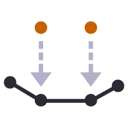
Station / Offset Points
Creates points through input of station and offset values with respect to a selected alignment. Elevations can be entered using Elevation, Delta Elevation or Cross Slope from the selected alignment.
Smart Join
Provides manual and fully automated methods to join CAD or PDF vector lines together quickly and easily. Solves common problems like line gaps, overlaps, crossovers, lateral gaps, lines on different layers, lines with different names or colors to provide an extremely fast way to join lines. Line segments can be selected in the most convenient location not just at the ends that you wish to join.
Crop Crossing Lines
Provides the ability to crop selected lines either side of a selected line or to remove the segments of selected lines between a pair of lines. This is useful to remove e.g. Contour lines from pavement areas or around curb and gutter sections, where more precise modeling techniques are being used.
Station / Offset Points
Creates points through input of station and offset values with respect to a selected alignment. Elevations can be entered using Elevation, Delta Elevation or Cross Slope from the selected alignment.

CAD Cleanup
Provides a work process tool to cleanup and sort imported CAD files. The command includes a CAD Block processor to manage and explode imported blocks, a Layer control to manage and group imported layers based on predefined rulesets, and a set of miscellaneous controls to delete imported plan sets, delete AEC object references, zero length lines and empty unprotected layers, change text to multiline text and change text styles to stroke fonts for improved graphics speed.

Explode Solids
Imported Solids, 3DShell or mesh objects from IFC, DWG and DGN files can be exploded into component lines and points using this command. The command handles solids by breaking them into top, bottom and side objects or 3D polygons on separate layers so that the data can be used as source data for surface models. 3D linear features can be re-created through use of the Filter by Alignment command.

Convert To Linestring
Provides a rapid way to mass convert polyline and CAD line objects into linestring objects. In addition the command provides an easy way to eliminate UCS (User Defined Coordinate Systems) from imported CAD objects or from objects created using the Cutting Plane View in TBC. You can also use this tool to eliminate horizontal or vertical vertices from selected linestrings e.g. to reduce nodes in contours or VPIs from imported CAD 3D lines. This increases your productivity and eliminates a large bottleneck in the processing of CAD data and point clouds.
Explode Solids
Imported Solids, 3DShell or mesh objects from IFC, DWG and DGN files can be exploded into component lines and points using this command. The command handles solids by breaking them into top, bottom and side objects or 3D polygons on separate layers so that the data can be used as source data for surface models. 3D linear features can be re-created through use of the Filter by Alignment command.
Name by Layer / Layer by Name
Name by Layer - Names line objects using the name of the objects layer. This is a useful tool to prepare imported CAD data for field users of Trimble Siteworks or SCS900 etc.
Layer by Name - Relayers objects based on the objects name. Layered objects can be placed in Layer Groups using a Layer Group mapping using filter elements of the objects name. This is useful for organizing surveyed data e.g. for utility relocates
Reverse Line
Reverse the direction of selected linestrings, CAD lines or polylines using a simple switch direction, align to an alignment or reference line, clockwise / anticlockwise (closed lines), or align with slope (from first to last node of the selected lines).
Convert To Linestring
Provides a rapid way to mass convert polyline and CAD line objects into linestring objects. In addition the command provides an easy way to eliminate UCS (User Defined Coordinate Systems) from imported CAD objects or from objects created using the Cutting Plane View in TBC. You can also use this tool to eliminate horizontal or vertical vertices from selected linestrings e.g. to reduce nodes in contours or VPIs from imported CAD 3D lines. This increases your productivity and eliminates a large bottleneck in the processing of CAD data and point clouds.

Adjust Linestring Elevation
Provides a quick and easy way to null out or modify VPIs on selected sections of 3D linestrings, adjust and prorate elevations for bridge beam deflections or to taper linework over selected distances to match existing grade. You can use this command in Spot mode to elevate lines. Plane Mode allows you to elevate e.g. curb lines onto tilted planes defined by 3 points. Surface Mode allows you to elevate e.g. curb lines onto a grading framework surface e.g. for Parking Lots. In Plane and Surface Mode you can specifically define how points are created around curve sections to improve the quality and consistency of your models.

QA Lines
Provides the ability to display the slope direction, slope value, slope or horizontal length and bearing allowing you to instantly identify lines / pipes that are too steep, too shallow, flowing the wrong direction or that fall within defined tolerance ranges. Color coding can be applied to show In / Out of tolerance.
Add Isopach
Computes a surcharge / overexcavation surface by adding a % of cut or fill depth to a selected surface. Can also be used to adjust a surface model to match grade at project limits or at other locations e.g. at bridge decks / abutments etc

Combine Surfaces
Combines multiple TIN surfaces from a design into a single TIN surface model comprising multiple islands. For example where an over excavation surface on a corridor model comes and goes along the alignment, or where the left embankment and right embankment were designed as separate components and you want to combine them into a single surface for TBC corridor or machine control purposes.
Extract Surface Features
Explodes a selected TIN surface model into 3D lines and or points. The explode process eliminates duplicate lines. The exploded surface can then be edited to remove erroneous data e.g. erroneous triangle sides or to be combined with other data to create a new surface model. Explode process also provides advanced filter controls to facilitate breakline, drapeline and boundary identification and extraction.
Offset Surface
Provides the ability to offset an entire surface or an area of a surface within a clipping boundary to create a new surface model. This is a quick and easy tool to create e.g. Topsoil Strip surfaces from an Existing Ground surface model.
Add Isopach
Computes a surcharge / overexcavation surface by adding a % of cut or fill depth to a selected surface. Can also be used to adjust a surface model to match grade at project limits or at other locations e.g. at bridge decks / abutments etc
Combine Surfaces
Combines multiple TIN surfaces from a design into a single TIN surface model comprising multiple islands. For example where an over excavation surface on a corridor model comes and goes along the alignment, or where the left embankment and right embankment were designed as separate components and you want to combine them into a single surface for TBC corridor or machine control purposes.
Extract Surface Features
Explodes a selected TIN surface model into 3D lines and or points. The explode process eliminates duplicate lines. The exploded surface can then be edited to remove erroneous data e.g. erroneous triangle sides or to be combined with other data to create a new surface model. Explode process also provides advanced filter controls to facilitate breakline, drapeline and boundary identification and extraction.
Multi Offset Lines
Template driven command that creates multiple offset lines (fully curvilinear lines) for multiple surfaces (finished grade and subgrade) on multiple layers (one per feature line) from selected source lines defined using offset and elevation, offset and delta elevation, offset and slope definitions. Ideal for curb & gutter, barriers, gabion walls, site /subdivision roads and more.
Offset Slope
Create a new 3D line at an offset and elevation difference to a selected pair of lines where the elevation of the new line is computed by extending the slope defined by the selected pair of lines and applying the elevation difference required. This tool is great for extending pavement or subgrade surfaces where the pavement surface is defined by imported 3D string (lines) data.
Offset Surface
Provides the ability to offset an entire surface or an area of a surface within a clipping boundary to create a new surface model. This is a quick and easy tool to create e.g. Topsoil Strip surfaces from an Existing Ground surface model.

Slope Designer
Provides the ability to create points and or lines using station and combination of either Offset and Elevation, Offset and Delta Elevation, Offset and Slope, Slope and Elevation, Slope and Delta Elevation or Slope and Target Surface. This provides an effective means of defining sideslopes, benches, berms, ponds or pad areas etc.

Slope Slope Intersect
This command provides the ability to compute 3D lines at the intersection of two slopes defined by two pairs of lines, with or without vertical or perpendicular offsets. The command is ideal for the computations of subgrade and topsoil adjusted embankment surfaces. All necessary offset lines are computed to facilitate rapid creation of the adjusted surface model.
Multi Offset Lines
Template driven command that creates multiple offset lines (fully curvilinear lines) for multiple surfaces (finished grade and subgrade) on multiple layers (one per feature line) from selected source lines defined using offset and elevation, offset and delta elevation, offset and slope definitions. Ideal for curb & gutter, barriers, gabion walls, site /subdivision roads and more.
Offset Slope
Create a new 3D line at an offset and elevation difference to a selected pair of lines where the elevation of the new line is computed by extending the slope defined by the selected pair of lines and applying the elevation difference required. This tool is great for extending pavement or subgrade surfaces where the pavement surface is defined by imported 3D string (lines) data.
Slope Designer
Provides the ability to create points and or lines using station and combination of either Offset and Elevation, Offset and Delta Elevation, Offset and Slope, Slope and Elevation, Slope and Delta Elevation or Slope and Target Surface. This provides an effective means of defining sideslopes, benches, berms, ponds or pad areas etc.

Create X-Lines
Generates section lines (XLines) and labels at defined locations along an alignment using defined layers and coloring (Corridor Intervals, Extra Stations, Typical Section locations, Slope Change locations, WIdth Change locations, crossing infrastructure (Utilities, Culverts etc.) for the purposes of annotating drawings.

Define Extra Stations
Add additional modeling and reporting stations into corridor models outside of the corridor model and template definition.
Explode Lines
Provides the ability to explode any linework into ether all segment elements or into top, bottom and side elements on separated layers (with a break angle control). Perfect for cross section takeoff from CAD or PDF files where e.g. material layers are drawn as closed polygon areas and you need to extract top or bottom of the layer onto separate layers to create models after section conversion.
RPS Extend Lines
Creates lead in and lead out line extensions on selected linestrings for stringless paver guidance. Elevation control is provided using extended slope of line first and last segments (curb and gutter) or from a selected target surface (man line pavers).
Geometric Selection
This powerful tool provides geometric selection properties for imported CAD or PDF linework. Initially conceived for the cross section takeoff workflows, this tool provides geometric controls that can be combined for extremely rapid selection and relayering of objects using length, aspect ratio and node count.

Increment Text
This command creates text that automatically increments between each text placement e.g. for labeling pads, parking bays or for adding station labels to PDF cross sections that have no text to use for section conversion.

Nudge
This command provides two main abilities, Nudge Line and Nudge Node. Nudge Line moves a selected line laterally by a defined amount in order to fix a surface model where two lines that define the top and bottom of a vertical wall or face lie on top of each other but separated vertically. Nudge Node is for cross sections where two or more nodes in the cross section lie in the same XY location but are separated vertically.

Optimize Linestrings
Converts chorded linework into optimized curvilinear linestrings in both horizontal and vertical components for use in stringless paving and to improve 3D models for corridors. Can also be used to convert chorded PDF Vector lines into curvilinear lines for modeling purposes.

Track Line Edge
This command allows you to pick an alignment and a selection of linework e.g. for road pavement section lines in order to create the edge lines (pavement edge lines) in the direction of increasing station and / or a boundary around the selected lines. Part of the CAD / PDF cross sections takeoff workflow, this facilitates rapid 3D modeling from converted PDF or CAD cross sections.
Station / Offset Points
Creates points through input of station and offset values with respect to a selected alignment. Elevations can be entered using Elevation, Delta Elevation or Cross Slope from the selected alignment.

Import Boring Logs
Imports boring log data from a CSV file to create site (Takeoff) boring logs in order to rapidly build strata layers for earthworks quantity purposes.
PDF Vectors on Demand
Extracts vectors from georeferenced PDF images on demand using automatic and manual process controls. Lines can be layered, joined and elevated in the process, eliminating multiple Takeoff steps and increasing productivity.

Site Improvement Legend
This command creates a legend of site improvements applied to surfaces within the project either for takeoff or data modeling purposes. The legend shows the color of the site improvement and the material layer stack and defined material thicknesses for each site improvement used. This automates the creation of drawings for submittals or for use by site personnel to understand a project.
Takeoff Lines
Creates 2D and 3D linestrings with a range of controls to manage elevation input and formulaic adjustment including 2D, single height, multiheight, multiheight auto and multiheight from surface. Also includes ability to create lines with a preset number of nodes, can autoclose and provide grip editing while in the command. Can also create curve elements and VPI only nodes also. Ideal for takeoff digitizing of linework or for data prep purposes.

Find Surface Area
Provides a fast and easy way to determine the surface and plan areas of bounded areas on surface models. The surface areas can be defined by collections of 3D breaklines in the surface with the "Sharp and Texture" property, or areas of the surface where surface textures have been defined. The computed areas can be labeled on the drawing using this command.
Explode Lines
Provides the ability to explode any linework into ether all segment elements or into top, bottom and side elements on separated layers (with a break angle control). Perfect for cross section takeoff from CAD or PDF files where e.g. material layers are drawn as closed polygon areas and you need to extract top or bottom of the layer onto separate layers to create models after section conversion.
RPS Extend Lines
Creates lead in and lead out line extensions on selected linestrings for stringless paver guidance. Elevation control is provided using extended slope of line first and last segments (curb and gutter) or from a selected target surface (man line pavers).
Geometric Selection
This powerful tool provides geometric selection properties for imported CAD or PDF linework. Initially conceived for the cross section takeoff workflows, this tool provides geometric controls that can be combined for extremely rapid selection and relayering of objects using length, aspect ratio and node count.
Increment Text
This command creates text that automatically increments between each text placement e.g. for labeling pads, parking bays or for adding station labels to PDF cross sections that have no text to use for section conversion.
Nudge
This command provides two main abilities, Nudge Line and Nudge Node. Nudge Line moves a selected line laterally by a defined amount in order to fix a surface model where two lines that define the top and bottom of a vertical wall or face lie on top of each other but separated vertically. Nudge Node is for cross sections where two or more nodes in the cross section lie in the same XY location but are separated vertically.
Track Line Edge
This command allows you to pick an alignment and a selection of linework e.g. for road pavement section lines in order to create the edge lines (pavement edge lines) in the direction of increasing station and / or a boundary around the selected lines. Part of the CAD / PDF cross sections takeoff workflow, this facilitates rapid 3D modeling from converted PDF or CAD cross sections.
Explode Lines
Provides the ability to explode any linework into ether all segment elements or into top, bottom and side elements on separated layers (with a break angle control). Perfect for cross section takeoff from CAD or PDF files where e.g. material layers are drawn as closed polygon areas and you need to extract top or bottom of the layer onto separate layers to create models after section conversion.
RPS Extend Lines
Creates lead in and lead out line extensions on selected linestrings for stringless paver guidance. Elevation control is provided using extended slope of line first and last segments (curb and gutter) or from a selected target surface (man line pavers).
Optimize Linestrings
Converts chorded linework into optimized curvilinear linestrings in both horizontal and vertical components for use in stringless paving and to improve 3D models for corridors. Can also be used to convert chorded PDF Vector lines into curvilinear lines for modeling purposes.

Export XML
Exports selected linestrings and alignments as 3D curvilinear alignments to LandXML format for use in Trimble Access and Leica stringless paver systems.

Point Cloud by Boundary
Create point cloud regions quickly from imported point clouds using predefined boundaries.

Point Cloud Processor
Processes Point Clouds to intelligently reduce the number of points in the point cloud using spatial analysis techniques that retain the integrity of the source data in the resulting point cloud scan. Inclusion and exclusion boundaries can be applied to eliminated unnecessary. Also creates surface(s) from the resulting data set that can also utilize the same boundary lines for inclusion / exclusion areas. Removes vegetation (Trees, Bushes, Shrubs and Grasses from Point Cloud Data to make clean usable surfaces for project quantities.

Label Points
This command provides additional drafting capabilities to label point values, delta elevations, slopes, station and offset to selected reference linestrings, alignments or surfaces for construction QA and As Built drawing creation purposes. The command also provides the ability to enter a High and Low tolerance in order to color code the text labels based on their High, Low or in Grade status.

RPS Copy to Clipboard
Copy data from one project to another or within an existing project using our virtual VCL file via the Windows clipboard. Ideal for creating copies of sheet sets complete with all settings within a project or for transferring information from one project into another without having to use Export and Import processes.
RPS Paste
Paste information from the Windows clipboard directly into your project drawings. Use with your favorite Windows clipping tool (Snagit, Snip and Paste etc.) to capture PDF sheet details, excel spreadsheet tables, images, text or virtual VCL data generated using RPS Copy to Clipboard command.

Unreleased - Label Lines
Label selected lines with names, slopes, lengths, elevations, stations, offsets, elevation deltas to a reference surface at intervals along the line or in relation to a selected reference line. Labels can be exported to machine files to assist operators on site. Labels can be staggered to avoid overwrite of text in graphics / CAD.
Polynomial Regrade
Compute polynomial best fit lines through points for regrading surfaces for solar farm array tables (Pre Piling).

Pile Definition Manager
Provides ability to create user defined pile definitions for Solar Farm piling operations to be used with RPS piling command capabilities.
Import Pile Plan
Customizable importer for spreadsheet data for Solar Farm Pile Plans and Piles to automatically create Pile design data ready for machine control or QA analysis. Also imports As Built Pile data from machine files (in Excel format) and Survey QA Data for measured check points on each pile (in Excel format).
Piling QA Report
Creates a multi tab Excel report on all quality metrics for solar farm piling operations. Integrates pile designs with As Built Pile results from machine data and as built survey information to analyze 6 quality metrics for every pile.
Export XML
Exports selected linestrings and alignments as 3D curvilinear alignments to LandXML format for use in Trimble Access and Leica stringless paver systems.
unlicensed-tools
Elevation Delta to Corridor
Creates an elevation delta profile for a line against a corridor

Perpendicular Distance to Surface
Compares a selection of 3D measured points to a 3D surface model and determines the shortest perpendicular distance between each point and the surface model. This is a great tool to check measured point data against a design surface for cuttings where the walls of the cutting are steep or near vertical. Generates an Excel report and 3D vector linework showing the computed distances.

Points to CSV
Creates a CSV output that reports a selection of points and compares them to a surface and optional alignment and incorporates the points description, layer, point name and attribute information. The cut and fill between the points and surface is also reported.

Points to Grid
Created to support production data from Leica machine control systems, this command allows the user to find the first, last, highest and lowest points in each grid cell from imported data files based on a defined grid pattern (origin, orientation, row and column spacing). The selected data is layered into separate layers so that it can be used to create different surface models.

Surface to Grid
Point clouds can be used to create surface models. The resulting surfaces can be large and are hard to report for QA / QC purposes. This command converts a TIN surface, optionally clipped to a boundary into a grid of points based on a regular or alignment based grid, and computes cut / fill values to a reference surface with applied high and low tolerances for reporting purposes.

Voice Command
Provides the ability to use voice input to execute any TBC command. This improves productivity and allows the commands to execute as well as the command dialog to be navigated without mouse movement.

Copy Layer Group Members
Copies a layer group and all the layers (that have members) into a new layer group where the group and each layer is named using the existing name with an added prefix or suffix.
Copy Layer Group Members
Copies a layer group and all the layers (that have members) into a new layer group where the group and each layer is named using the existing name with an added prefix or suffix.

Insert Line Segment
A simple editing tool to add additional segments into an existing linestring. Simply click where you require additional nodes and the linestring selected updates by adding additional segments into the existing linestring. You can use this command to insert segments into the line or to add segments at either end of the line.

Quick Line
Create 3D linestrings quickly without the complexity of the Linestring Editor.

Switch Text
Switch text properties between two selected text objects. Text properties include height, width, text, rotation, oblique angle, justification, aspect ratio, layer, color etc.

Affix Name
Applies and / or removes a user specified prefix or suffix the name of the selected objects.

Points to Arc
Provides the ability to create best fit 3D arcs on planes defined by three 3D points. Great for Architectural detailing from points measured with Total Stations or Scanners.

Divide by Slope Distance
Computes points along a selected 3D line using a table of variable slope distances as the divisor. A good tool for rapidly creating building grid layouts.
Points to Station
Provides the ability to move selected survey points onto even station locations within a move tolerance for reporting purposes.
Station / Offset Points
Creates points through input of station and offset values with respect to a selected alignment. Elevations can be entered using Elevation, Delta Elevation or Cross Slope from the selected alignment.
Insert Line Segment
A simple editing tool to add additional segments into an existing linestring. Simply click where you require additional nodes and the linestring selected updates by adding additional segments into the existing linestring. You can use this command to insert segments into the line or to add segments at either end of the line.
Quick Line
Create 3D linestrings quickly without the complexity of the Linestring Editor.
Points to Arc
Provides the ability to create best fit 3D arcs on planes defined by three 3D points. Great for Architectural detailing from points measured with Total Stations or Scanners.
Station / Offset Points
Creates points through input of station and offset values with respect to a selected alignment. Elevations can be entered using Elevation, Delta Elevation or Cross Slope from the selected alignment.
Convert To Linestring
Provides a rapid way to mass convert polyline and CAD line objects into linestring objects. In addition the command provides an easy way to eliminate UCS (User Defined Coordinate Systems) from imported CAD objects or from objects created using the Cutting Plane View in TBC. You can also use this tool to eliminate horizontal or vertical vertices from selected linestrings e.g. to reduce nodes in contours or VPIs from imported CAD 3D lines. This increases your productivity and eliminates a large bottleneck in the processing of CAD data and point clouds.
Affix Name
Applies and / or removes a user specified prefix or suffix the name of the selected objects.

Filter by Alignment
Provides the ability to filter a selection of objects in relation to a selected reference line or alignment. User can define parallel or perpendicular or up to a specified skew angle to rapidly find linear features or cross section lines across surfaces. Useful tool with Explode Surface or Explode IFC Shell commands.

Lines To AOI
Converts selected linework into AOIs for Takeoff reports (Areas of Interest).
Points to Station
Provides the ability to move selected survey points onto even station locations within a move tolerance for reporting purposes.
Convert To Linestring
Provides a rapid way to mass convert polyline and CAD line objects into linestring objects. In addition the command provides an easy way to eliminate UCS (User Defined Coordinate Systems) from imported CAD objects or from objects created using the Cutting Plane View in TBC. You can also use this tool to eliminate horizontal or vertical vertices from selected linestrings e.g. to reduce nodes in contours or VPIs from imported CAD 3D lines. This increases your productivity and eliminates a large bottleneck in the processing of CAD data and point clouds.

Adjust Area
This computes the accurate placement for a line that creates a boundary area equal to a specified input. Use this command to divide pavement areas up into predefined daily production areas, or create lots of a defined size between a selection of at least three source lines e.g. an end and two edge of pavement lines.

Compute Lot Setback
Computes the optimal location for a pad on a lot using required minimum setbacks from frontage and side lot lines. One lot side can also be defined as an edge frontage.

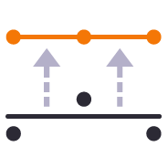
VPI at Elevation
Creates VPIs on the selected line at the specified elevation each time the line passes through the defined elevation

QA Road Lines
Creates a profile in the alignment profile view for a corridor that shows the delta elevation between a selected 3D line and the selected corridor material surface layer e.g. Finished Grade. Used as a check between survey data and a selected corridor model or to determine the variance of cross slope along an alignment based on survey information.
Add Isopach
Computes a surcharge / overexcavation surface by adding a % of cut or fill depth to a selected surface. Can also be used to adjust a surface model to match grade at project limits or at other locations e.g. at bridge decks / abutments etc
Offset Surface
Provides the ability to offset an entire surface or an area of a surface within a clipping boundary to create a new surface model. This is a quick and easy tool to create e.g. Topsoil Strip surfaces from an Existing Ground surface model.
Surface to Points
Surface models provided by Engineers for Existing Ground are often derived from point clouds. The imported TINs often cover large areas and have extremely dense triangulation. For modeling purposes the imported TIN and CAD points derived from the TIN are inefficient in TBC. This command provides the ability to convert the TIN back into a point cloud so that it can be more easily and faster handled in TBC. It can also be reduced in size and point density for faster volume computations.
Add Isopach
Computes a surcharge / overexcavation surface by adding a % of cut or fill depth to a selected surface. Can also be used to adjust a surface model to match grade at project limits or at other locations e.g. at bridge decks / abutments etc

Best Fit Linestring
Creates a best fit horizontal and or vertical alignment geometry to a selected 3D linestring. Can be used to define a new alignment and profile for a pavement or regrading surface based on surveyed data along the centerline for example.
Offset Slope
Create a new 3D line at an offset and elevation difference to a selected pair of lines where the elevation of the new line is computed by extending the slope defined by the selected pair of lines and applying the elevation difference required. This tool is great for extending pavement or subgrade surfaces where the pavement surface is defined by imported 3D string (lines) data.
Offset Surface
Provides the ability to offset an entire surface or an area of a surface within a clipping boundary to create a new surface model. This is a quick and easy tool to create e.g. Topsoil Strip surfaces from an Existing Ground surface model.
Slope Slope Intersect
This command provides the ability to compute 3D lines at the intersection of two slopes defined by two pairs of lines, with or without vertical or perpendicular offsets. The command is ideal for the computations of subgrade and topsoil adjusted embankment surfaces. All necessary offset lines are computed to facilitate rapid creation of the adjusted surface model.
Surface to Points
Surface models provided by Engineers for Existing Ground are often derived from point clouds. The imported TINs often cover large areas and have extremely dense triangulation. For modeling purposes the imported TIN and CAD points derived from the TIN are inefficient in TBC. This command provides the ability to convert the TIN back into a point cloud so that it can be more easily and faster handled in TBC. It can also be reduced in size and point density for faster volume computations.
Best Fit Linestring
Creates a best fit horizontal and or vertical alignment geometry to a selected 3D linestring. Can be used to define a new alignment and profile for a pavement or regrading surface based on surveyed data along the centerline for example.
Offset Slope
Create a new 3D line at an offset and elevation difference to a selected pair of lines where the elevation of the new line is computed by extending the slope defined by the selected pair of lines and applying the elevation difference required. This tool is great for extending pavement or subgrade surfaces where the pavement surface is defined by imported 3D string (lines) data.
Edit Alignment as Spreadsheet
Capture alignment details in a spreadsheet and then import it into Trimble Business Center using this command. Command also allows the user to open an imported or hand entered alignment in a spreadsheet for checking and analysis.
Explode Lines
Provides the ability to explode any linework into ether all segment elements or into top, bottom and side elements on separated layers (with a break angle control). Perfect for cross section takeoff from CAD or PDF files where e.g. material layers are drawn as closed polygon areas and you need to extract top or bottom of the layer onto separate layers to create models after section conversion.
Increment Text
This command creates text that automatically increments between each text placement e.g. for labeling pads, parking bays or for adding station labels to PDF cross sections that have no text to use for section conversion.
Track Line Edge
This command allows you to pick an alignment and a selection of linework e.g. for road pavement section lines in order to create the edge lines (pavement edge lines) in the direction of increasing station and / or a boundary around the selected lines. Part of the CAD / PDF cross sections takeoff workflow, this facilitates rapid 3D modeling from converted PDF or CAD cross sections.
Station / Offset Points
Creates points through input of station and offset values with respect to a selected alignment. Elevations can be entered using Elevation, Delta Elevation or Cross Slope from the selected alignment.
Lines To AOI
Converts selected linework into AOIs for Takeoff reports (Areas of Interest).
Site Improvement Legend
This command creates a legend of site improvements applied to surfaces within the project either for takeoff or data modeling purposes. The legend shows the color of the site improvement and the material layer stack and defined material thicknesses for each site improvement used. This automates the creation of drawings for submittals or for use by site personnel to understand a project.
Find Surface Area
Provides a fast and easy way to determine the surface and plan areas of bounded areas on surface models. The surface areas can be defined by collections of 3D breaklines in the surface with the "Sharp and Texture" property, or areas of the surface where surface textures have been defined. The computed areas can be labeled on the drawing using this command.
Explode Lines
Provides the ability to explode any linework into ether all segment elements or into top, bottom and side elements on separated layers (with a break angle control). Perfect for cross section takeoff from CAD or PDF files where e.g. material layers are drawn as closed polygon areas and you need to extract top or bottom of the layer onto separate layers to create models after section conversion.
Increment Text
This command creates text that automatically increments between each text placement e.g. for labeling pads, parking bays or for adding station labels to PDF cross sections that have no text to use for section conversion.
Track Line Edge
This command allows you to pick an alignment and a selection of linework e.g. for road pavement section lines in order to create the edge lines (pavement edge lines) in the direction of increasing station and / or a boundary around the selected lines. Part of the CAD / PDF cross sections takeoff workflow, this facilitates rapid 3D modeling from converted PDF or CAD cross sections.
Explode Lines
Provides the ability to explode any linework into ether all segment elements or into top, bottom and side elements on separated layers (with a break angle control). Perfect for cross section takeoff from CAD or PDF files where e.g. material layers are drawn as closed polygon areas and you need to extract top or bottom of the layer onto separate layers to create models after section conversion.
Point Cloud by Boundary
Create point cloud regions quickly from imported point clouds using predefined boundaries.

Points to Cloud Report
Compares a selection of points to a point cloud region or scan to determine the nearest scan point to the selected points, and provides a comparison between the derived point pairs. This is a useful tool to compare measured ground check points with computed point clouds from drone surveys to validate drone survey accuracy.
other-support-tools

Getting Started
One click access to Getting Started instructions for the RPS Command library

Rockpile Website
One click access to the Rockpile Solutions website

MyRockpile Community
One click access to the MyRockpile Community forum

Rockpile Library
One click access to the MyRockpile Library for all your training needs

Rockpile Training
Upcoming training opportunities with Rockpile Solutions

One click access to the Rockpile Solutions LinkedIn page

YouTube
One click access to the Rockpile Solutions YouTube page

One click access to the Rockpile Solutions Instagram page

Support
One click access to generate a Support Ticket for RPS staff assistance

Rockpile Contact
The Contact Us command allows you to raise a question to Rockpile Solutions staff directly from inside Trimble Business Center.
system-tools

TMLStatus
Track and manage the installation and update of registered RPS commands

RPS Settings
Manage your global RPS command settings

Show Line Direction
Show the direction of a selected line

Menu Manager
Toggle between light and dark Mode menu color schemes

RPS Help
Access to Rockpile Solutions Online Help System.

Shortcut Manager
Creates and manages TBC keyboard shortcuts for commands and provides the ability to save different shortcut definitions into settings files for easy recall.

Toolbar Manager
Utility that provides the ability to save out your custom toolbars and import them back into a different menu configuration
Voice Command
Provides the ability to use voice input to execute any TBC command. This improves productivity and allows the commands to execute as well as the command dialog to be navigated without mouse movement.
secondary-licensed-commands
Perpendicular Distance to Surface
Compares a selection of 3D measured points to a 3D surface model and determines the shortest perpendicular distance between each point and the surface model. This is a great tool to check measured point data against a design surface for cuttings where the walls of the cutting are steep or near vertical. Generates an Excel report and 3D vector linework showing the computed distances.
Points to CSV
Creates a CSV output that reports a selection of points and compares them to a surface and optional alignment and incorporates the points description, layer, point name and attribute information. The cut and fill between the points and surface is also reported.
Points to Grid
Created to support production data from Leica machine control systems, this command allows the user to find the first, last, highest and lowest points in each grid cell from imported data files based on a defined grid pattern (origin, orientation, row and column spacing). The selected data is layered into separate layers so that it can be used to create different surface models.
Surface to Grid
Point clouds can be used to create surface models. The resulting surfaces can be large and are hard to report for QA / QC purposes. This command converts a TIN surface, optionally clipped to a boundary into a grid of points based on a regular or alignment based grid, and computes cut / fill values to a reference surface with applied high and low tolerances for reporting purposes.
Modify ASCII File
Utility to modify the contents of an Ascii file (csv, pts, xyz, ...) using formulas to alter columns of data
Copy Layer Group Members
Copies a layer group and all the layers (that have members) into a new layer group where the group and each layer is named using the existing name with an added prefix or suffix.

Layer Manager
RPS Layer Manager provides a rapid way to assign selected layers to layer groups and to add prefix or suffix text to layer names and layer groups. You can also use Search and Replace to modify the names of selected layers.
Copy Layer Group Members
Copies a layer group and all the layers (that have members) into a new layer group where the group and each layer is named using the existing name with an added prefix or suffix.
Insert Line Segment
A simple editing tool to add additional segments into an existing linestring. Simply click where you require additional nodes and the linestring selected updates by adding additional segments into the existing linestring. You can use this command to insert segments into the line or to add segments at either end of the line.
Layer Manager
RPS Layer Manager provides a rapid way to assign selected layers to layer groups and to add prefix or suffix text to layer names and layer groups. You can also use Search and Replace to modify the names of selected layers.

Lock Views
Provides the ability to create two separate plan views displaying different information and synchronize pan and zoom activities so that the same location can be seen in both windows for direct comparison. Combine View Filters, Selection Sets and Lock Views to rapidly identify changes in project revision drawings or to compare weekly / monthly check surveys.

Matrix Copy
A copy command that provides the ability to multi copy selected objects into a 3D array. User can define the origin, orientation / skew angle, inclination and spacing of the three grid axes. The command is great for creating parking bay striping, site mass haul grids, building piers, stairways and other repetitive patterns on a regular 2D or 3D grid
Quick Line
Create 3D linestrings quickly without the complexity of the Linestring Editor.
Rotate Plan View
Provides the ability to manage plan view rotation in relation to lines and alignments or text items or simply freeform. You can also use this command to reset your plan rotation to North Up. Rotate your plan view as you browse along lines or alignments to make PDF plans or text display items easily readable or simply to maximize the use of screen real estate.
Switch Text
Switch text properties between two selected text objects. Text properties include height, width, text, rotation, oblique angle, justification, aspect ratio, layer, color etc.
Affix Name
Applies and / or removes a user specified prefix or suffix the name of the selected objects.

Name by Text
Names polygonal line objects using text data located inside the polygon. Used to name lots, pads, parking stalls, buildings and other polygonal objects. This is a useful tool to prepare imported CAD data for field users of Trimble Siteworks or SCS900 etc.
Points to Arc
Provides the ability to create best fit 3D arcs on planes defined by three 3D points. Great for Architectural detailing from points measured with Total Stations or Scanners.
Divide by Slope Distance
Computes points along a selected 3D line using a table of variable slope distances as the divisor. A good tool for rapidly creating building grid layouts.

Place Aligned Blocks
Provides the ability to place a block automatically on a selection of points and orientate them in relation to a selected line or alignment. Great for placing sound wall or guard rail posts and footings along their feature lines. Blocks get rotated into the correct orientation along curves and at angle corners. Enables the rapid creation of layout data for anchor bolts and 3D visual elements for the SiteVision Augmented Reality system etc.
Points to Station
Provides the ability to move selected survey points onto even station locations within a move tolerance for reporting purposes.

Radial Points
Creates points along radius lines and at intervals using polar coordinate geometry calculations.

Radial Points (Script)
Creates irregular point sequences along multiple radius lines using scripted polar coordinate geometry calculations. Ideal for complex layout of circular structures. Created scripts can be saved and reused, ideal for large tank or silo farms.
Insert Line Segment
A simple editing tool to add additional segments into an existing linestring. Simply click where you require additional nodes and the linestring selected updates by adding additional segments into the existing linestring. You can use this command to insert segments into the line or to add segments at either end of the line.
Matrix Copy
A copy command that provides the ability to multi copy selected objects into a 3D array. User can define the origin, orientation / skew angle, inclination and spacing of the three grid axes. The command is great for creating parking bay striping, site mass haul grids, building piers, stairways and other repetitive patterns on a regular 2D or 3D grid
Quick Line
Create 3D linestrings quickly without the complexity of the Linestring Editor.
Points to Arc
Provides the ability to create best fit 3D arcs on planes defined by three 3D points. Great for Architectural detailing from points measured with Total Stations or Scanners.
Place Aligned Blocks
Provides the ability to place a block automatically on a selection of points and orientate them in relation to a selected line or alignment. Great for placing sound wall or guard rail posts and footings along their feature lines. Blocks get rotated into the correct orientation along curves and at angle corners. Enables the rapid creation of layout data for anchor bolts and 3D visual elements for the SiteVision Augmented Reality system etc.
Radial Points
Creates points along radius lines and at intervals using polar coordinate geometry calculations.
Radial Points (Script)
Creates irregular point sequences along multiple radius lines using scripted polar coordinate geometry calculations. Ideal for complex layout of circular structures. Created scripts can be saved and reused, ideal for large tank or silo farms.
Lock Views
Provides the ability to create two separate plan views displaying different information and synchronize pan and zoom activities so that the same location can be seen in both windows for direct comparison. Combine View Filters, Selection Sets and Lock Views to rapidly identify changes in project revision drawings or to compare weekly / monthly check surveys.
Rotate Plan View
Provides the ability to manage plan view rotation in relation to lines and alignments or text items or simply freeform. You can also use this command to reset your plan rotation to North Up. Rotate your plan view as you browse along lines or alignments to make PDF plans or text display items easily readable or simply to maximize the use of screen real estate.

Convert to MText
Converts selected CAD text objects to multiline text objects. Multiline text objects are smarter and have more flexibility in TBC than simple text objects.

Remove Duplicates
Specify color, layer, position tolerance and text case parameters to identify duplicate text items and relayer or delete those identified as duplicates from imported CAD or vector PDF files.
Convert to MText
Converts selected CAD text objects to multiline text objects. Multiline text objects are smarter and have more flexibility in TBC than simple text objects.
Remove Duplicates
Specify color, layer, position tolerance and text case parameters to identify duplicate text items and relayer or delete those identified as duplicates from imported CAD or vector PDF files.
Affix Name
Applies and / or removes a user specified prefix or suffix the name of the selected objects.
Filter by Alignment
Provides the ability to filter a selection of objects in relation to a selected reference line or alignment. User can define parallel or perpendicular or up to a specified skew angle to rapidly find linear features or cross section lines across surfaces. Useful tool with Explode Surface or Explode IFC Shell commands.
Lines To AOI
Converts selected linework into AOIs for Takeoff reports (Areas of Interest).
Points to Station
Provides the ability to move selected survey points onto even station locations within a move tolerance for reporting purposes.
Adjust Area
This computes the accurate placement for a line that creates a boundary area equal to a specified input. Use this command to divide pavement areas up into predefined daily production areas, or create lots of a defined size between a selection of at least three source lines e.g. an end and two edge of pavement lines.
Compute Lot Setback
Computes the optimal location for a pad on a lot using required minimum setbacks from frontage and side lot lines. One lot side can also be defined as an edge frontage.

Elevate by Attribute
Applies elevation attributes from imported GIS data to the lines associated with the attribute to create 3D linework suited to 3D modeling. Works well with ESRI Shape files.
VPI at Elevation
Creates VPIs on the selected line at the specified elevation each time the line passes through the defined elevation
QA Road Lines
Creates a profile in the alignment profile view for a corridor that shows the delta elevation between a selected 3D line and the selected corridor material surface layer e.g. Finished Grade. Used as a check between survey data and a selected corridor model or to determine the variance of cross slope along an alignment based on survey information.

Surface Intersection Linestring
Creates a line along the zero cut/fill line between two selected surface models. The lines created are set to sharp and texture boundary and can be optionally included in either or both of the source surface models.
Surface to Points
Surface models provided by Engineers for Existing Ground are often derived from point clouds. The imported TINs often cover large areas and have extremely dense triangulation. For modeling purposes the imported TIN and CAD points derived from the TIN are inefficient in TBC. This command provides the ability to convert the TIN back into a point cloud so that it can be more easily and faster handled in TBC. It can also be reduced in size and point density for faster volume computations.
Best Fit Linestring
Creates a best fit horizontal and or vertical alignment geometry to a selected 3D linestring. Can be used to define a new alignment and profile for a pavement or regrading surface based on surveyed data along the centerline for example.
Edit Alignment as Spreadsheet
Capture alignment details in a spreadsheet and then import it into Trimble Business Center using this command. Command also allows the user to open an imported or hand entered alignment in a spreadsheet for checking and analysis.

Linestring by Station
Creates a linestring from selected points sorted by station in relation to a selected line or alignment. Points with matching feature codes will be joined into a single or multiple lines.
Lines To AOI
Converts selected linework into AOIs for Takeoff reports (Areas of Interest).
Face Analyzer
Compares point cloud data or normal point data to the faces of 3D solids for QA and QC purposes. Creates projected plane plan view for each face analyzed with projected point data and tabulated QA/QC results for drawing / documentation creation purposes. Creates a "pin cushion" model with color coded pins to display points that are in tolerance, near tolerance or out of tolerance (high/low or ionside/outside the selected faces.
Points to Cloud Report
Compares a selection of points to a point cloud region or scan to determine the nearest scan point to the selected points, and provides a comparison between the derived point pairs. This is a useful tool to compare measured ground check points with computed point clouds from drone surveys to validate drone survey accuracy.

Cut Fill Labels
Creates additional Cut Fill Labels on a cut fill map in user defined spot locations or along linear features defined in the project.

Create Slope Indicators
Creates slope indicators (hachures) between two breaklines used in a surface model that represent the top and toe of slope. Use the created slope indicators to improve the smoothness of large slope areas on embankments to eliminate blade chatter on the machine or wavy / undulating surfaces on site.

Permit Area Manager
Provides a fast and easy way to manage project permit areas that are open or closed at any time. The tool provides the ability to create boundary areas, assign them attributes of Open or Closed as well as define a maximum value for total open area at any one time. A table can then be placed in the plan view that contains all Permit Areas, their Open / Closed state and a warning if total Open area exceeds the target maximum. Permit Areas are shaded based on their open or closed state.

Text Style Manager
Create and manage Text Styles providing a True Type and Stroked Font for each style defined. Toggle CAD display from True Type to Stroke font for CAD graphics speed on large CAD files or for presentation quality outputs. Import and export text styles for easy transfer between projects.

View Filter Override
This command provides the ability to override object colors for plotting purposes. If you want to create a black and white, grey scale or highlighted print or PDF output then this is your tool.

Rename Drill Holes
Provides the ability to rename / renumber drill holes in a drill plan, allowing for irregular shaped boundaries, the addition of extra drill holes and the movement of drill holes to allow for fault patterns through the drilling area. All holes are renamed uniquely and regularly along rows and columns of the drill plan. Drill hole names / numbers can be defined using a user defined name pattern.

CIVRobotics Manager
Exports stakeout point data and emails the information to a selected CIVRobotics Staking Robot. Imports CIVRobotic As Staked files and creates As Staked Records for reporting purposes.
Export HCSS
Exports an Alignment to the csv file format required by HCSS Plans.

MOSS / MX GENIO Export
Provides a high quality MOSS / MX GENIO export from either finished survey drawings (as a survey deliverable) or from a corridor linework model (imported or created by TBC) for use with Trimble Access (Trimble Access Road Strings). The MOSS Export process can utilize the layer names of the exported objects or the feature code library associated with the data, combined with a sophisticated mapping process to meet the MOSS / MX 4 character string naming needs.
Earthworks Work Orders
The Earthworks command provides a direct connection to the RPS Earthworks web system that enables the publishing of Work Orders (Design and Existing Surfaces) plus map overlays (linework) and image overlays (aerial images and Cut Fill Maps).

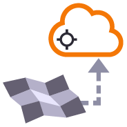
Earthworks Website
Provides one click access and login to the RPS Earthworks Web Software.

Unreleased - Export IFC
Export CAD lines, polygons and surfaces to IFC format for use in BIM Modeling / Viewing Systems and for use in Trimble Access or other field systems that support IFC files as a source of design information.
licensed-tools
Corridor As Built Report
Creates a formatted Excel Spreadsheet report from measured 3D points aligned to specified station intervals against a line or alignment, sorted from Left to Right across the alignment where each column of data is a specified code and the value presented is the Delta Elevation between the measured point and the referenced surface elevation.
Corridor Cut Sheet Report
Generates a Cut Sheet Report for Project Supervisors that shows full cross section details of slope, elevation, offset, delta elevation and cut/fill for user selected nodes of a corridor cross section material layer surface e.g. Finished Grade. The report generates a section at every defined interval plus all critical locations (PC, PT, VPI etc.) as well as every table and superelevation instruction location.
Point Detail Report
Creates and opens a CSV report in Excel that tabulates a custom selection of values relating to the selected points including local and global coordinates, feature codes, attributes, media files, station, offset, slope and delta elevations to lines, delta elevations to surfaces, siurface slope and direction and more. Feature codes are grouped and reported based on common attribute sets for easy reading. Custom reports can be created and saved for reuse in any TBC project.
Volumes Manager
Create and manage boundaries, boundary collections and boundary groups. Compute and store volume calculations for later recall. Label and annotate drawings with volume labels and tables and generate volume reports for a variety of volumetric scenarios e.g. Stockpiles, Progress, Cut / Fill, Pay Quantities etc.
Surface Area by Slope Ranges
Reports the plan and slope areas for cut and fill broken down by specified slope ranges on each of two surfaces. The report uses the isopach computed between the two surfaces (e.g. Existing and Subgrade Adjusted Finished Grade) to determine cut and fill areas and then sums the areas of triangles of both surfaces that fall within the defined slope ranges within the computed cut and fill areas. Ideal for the determination of surface finishing / trim areas in fill scenarios.
Modify ASCII File
Utility to modify the contents of an Ascii file (csv, pts, xyz, ...) using formulas to alter columns of data
Layer Manager
RPS Layer Manager provides a rapid way to assign selected layers to layer groups and to add prefix or suffix text to layer names and layer groups. You can also use Search and Replace to modify the names of selected layers.
New Layer
Utilizes the RPS New Layer control to create a new layer, new layer group and assign layer properties including the takeoff categorization, potential site improvement or surface boundaries and associated site improvement attributes.
Relayer
The RPS Relayer command provides increased productivity when relayering CAD objects to a number of different layers. The user can establish any number of target layers and then simply select the objects to relayer, tag the layer that they want to move them to and OK to execute. The fact that you can relayer to multiple layers quickly and easily can take significant time out of data prep processes.
Layer Manager
RPS Layer Manager provides a rapid way to assign selected layers to layer groups and to add prefix or suffix text to layer names and layer groups. You can also use Search and Replace to modify the names of selected layers.
Lock Views
Provides the ability to create two separate plan views displaying different information and synchronize pan and zoom activities so that the same location can be seen in both windows for direct comparison. Combine View Filters, Selection Sets and Lock Views to rapidly identify changes in project revision drawings or to compare weekly / monthly check surveys.
Matrix Copy
A copy command that provides the ability to multi copy selected objects into a 3D array. User can define the origin, orientation / skew angle, inclination and spacing of the three grid axes. The command is great for creating parking bay striping, site mass haul grids, building piers, stairways and other repetitive patterns on a regular 2D or 3D grid
New Layer
Utilizes the RPS New Layer control to create a new layer, new layer group and assign layer properties including the takeoff categorization, potential site improvement or surface boundaries and associated site improvement attributes.
Relayer
The RPS Relayer command provides increased productivity when relayering CAD objects to a number of different layers. The user can establish any number of target layers and then simply select the objects to relayer, tag the layer that they want to move them to and OK to execute. The fact that you can relayer to multiple layers quickly and easily can take significant time out of data prep processes.
Rotate Plan View
Provides the ability to manage plan view rotation in relation to lines and alignments or text items or simply freeform. You can also use this command to reset your plan rotation to North Up. Rotate your plan view as you browse along lines or alignments to make PDF plans or text display items easily readable or simply to maximize the use of screen real estate.
Smart Copy
Create multiple copies of any objects quickly on the same or different layers, in 2D or 3D and in any view
Smart Join
Provides manual and fully automated methods to join CAD or PDF vector lines together quickly and easily. Solves common problems like line gaps, overlaps, crossovers, lateral gaps, lines on different layers, lines with different names or colors to provide an extremely fast way to join lines. Line segments can be selected in the most convenient location not just at the ends that you wish to join.
Crop Crossing Lines
Provides the ability to crop selected lines either side of a selected line or to remove the segments of selected lines between a pair of lines. This is useful to remove e.g. Contour lines from pavement areas or around curb and gutter sections, where more precise modeling techniques are being used.
Name by Layer / Layer by Name
Name by Layer - Names line objects using the name of the objects layer. This is a useful tool to prepare imported CAD data for field users of Trimble Siteworks or SCS900 etc.
Layer by Name - Relayers objects based on the objects name. Layered objects can be placed in Layer Groups using a Layer Group mapping using filter elements of the objects name. This is useful for organizing surveyed data e.g. for utility relocates
Name by Text
Names polygonal line objects using text data located inside the polygon. Used to name lots, pads, parking stalls, buildings and other polygonal objects. This is a useful tool to prepare imported CAD data for field users of Trimble Siteworks or SCS900 etc.
Reverse Line
Reverse the direction of selected linestrings, CAD lines or polylines using a simple switch direction, align to an alignment or reference line, clockwise / anticlockwise (closed lines), or align with slope (from first to last node of the selected lines).
Takeoff Lines
Creates 2D and 3D linestrings with a range of controls to manage elevation input and formulaic adjustment including 2D, single height, multiheight, multiheight auto and multiheight from surface. Also includes ability to create lines with a preset number of nodes, can autoclose and provide grip editing while in the command. Can also create curve elements and VPI only nodes also. Ideal for takeoff digitizing of linework or for data prep purposes.
Place Aligned Blocks
Provides the ability to place a block automatically on a selection of points and orientate them in relation to a selected line or alignment. Great for placing sound wall or guard rail posts and footings along their feature lines. Blocks get rotated into the correct orientation along curves and at angle corners. Enables the rapid creation of layout data for anchor bolts and 3D visual elements for the SiteVision Augmented Reality system etc.
Point Creator
Provides the ability to create points for stakeout on lines and alignments at intervals, extra stations, key locations, high and low points, radius points and more.
Radial Points
Creates points along radius lines and at intervals using polar coordinate geometry calculations.
Radial Points (Script)
Creates irregular point sequences along multiple radius lines using scripted polar coordinate geometry calculations. Ideal for complex layout of circular structures. Created scripts can be saved and reused, ideal for large tank or silo farms.
Matrix Copy
A copy command that provides the ability to multi copy selected objects into a 3D array. User can define the origin, orientation / skew angle, inclination and spacing of the three grid axes. The command is great for creating parking bay striping, site mass haul grids, building piers, stairways and other repetitive patterns on a regular 2D or 3D grid
Smart Join
Provides manual and fully automated methods to join CAD or PDF vector lines together quickly and easily. Solves common problems like line gaps, overlaps, crossovers, lateral gaps, lines on different layers, lines with different names or colors to provide an extremely fast way to join lines. Line segments can be selected in the most convenient location not just at the ends that you wish to join.
Crop Crossing Lines
Provides the ability to crop selected lines either side of a selected line or to remove the segments of selected lines between a pair of lines. This is useful to remove e.g. Contour lines from pavement areas or around curb and gutter sections, where more precise modeling techniques are being used.
Place Aligned Blocks
Provides the ability to place a block automatically on a selection of points and orientate them in relation to a selected line or alignment. Great for placing sound wall or guard rail posts and footings along their feature lines. Blocks get rotated into the correct orientation along curves and at angle corners. Enables the rapid creation of layout data for anchor bolts and 3D visual elements for the SiteVision Augmented Reality system etc.
Radial Points
Creates points along radius lines and at intervals using polar coordinate geometry calculations.
Radial Points (Script)
Creates irregular point sequences along multiple radius lines using scripted polar coordinate geometry calculations. Ideal for complex layout of circular structures. Created scripts can be saved and reused, ideal for large tank or silo farms.
Lock Views
Provides the ability to create two separate plan views displaying different information and synchronize pan and zoom activities so that the same location can be seen in both windows for direct comparison. Combine View Filters, Selection Sets and Lock Views to rapidly identify changes in project revision drawings or to compare weekly / monthly check surveys.
Rotate Plan View
Provides the ability to manage plan view rotation in relation to lines and alignments or text items or simply freeform. You can also use this command to reset your plan rotation to North Up. Rotate your plan view as you browse along lines or alignments to make PDF plans or text display items easily readable or simply to maximize the use of screen real estate.
CAD Cleanup
Provides a work process tool to cleanup and sort imported CAD files. The command includes a CAD Block processor to manage and explode imported blocks, a Layer control to manage and group imported layers based on predefined rulesets, and a set of miscellaneous controls to delete imported plan sets, delete AEC object references, zero length lines and empty unprotected layers, change text to multiline text and change text styles to stroke fonts for improved graphics speed.
Convert to MText
Converts selected CAD text objects to multiline text objects. Multiline text objects are smarter and have more flexibility in TBC than simple text objects.
Explode Solids
Imported Solids, 3DShell or mesh objects from IFC, DWG and DGN files can be exploded into component lines and points using this command. The command handles solids by breaking them into top, bottom and side objects or 3D polygons on separate layers so that the data can be used as source data for surface models. 3D linear features can be re-created through use of the Filter by Alignment command.
Remove Duplicates
Specify color, layer, position tolerance and text case parameters to identify duplicate text items and relayer or delete those identified as duplicates from imported CAD or vector PDF files.
Name by Layer / Layer by Name
Name by Layer - Names line objects using the name of the objects layer. This is a useful tool to prepare imported CAD data for field users of Trimble Siteworks or SCS900 etc.
Layer by Name - Relayers objects based on the objects name. Layered objects can be placed in Layer Groups using a Layer Group mapping using filter elements of the objects name. This is useful for organizing surveyed data e.g. for utility relocates
Reverse Line
Reverse the direction of selected linestrings, CAD lines or polylines using a simple switch direction, align to an alignment or reference line, clockwise / anticlockwise (closed lines), or align with slope (from first to last node of the selected lines).
Adjust Linestring Elevation
Provides a quick and easy way to null out or modify VPIs on selected sections of 3D linestrings, adjust and prorate elevations for bridge beam deflections or to taper linework over selected distances to match existing grade. You can use this command in Spot mode to elevate lines. Plane Mode allows you to elevate e.g. curb lines onto tilted planes defined by 3 points. Surface Mode allows you to elevate e.g. curb lines onto a grading framework surface e.g. for Parking Lots. In Plane and Surface Mode you can specifically define how points are created around curve sections to improve the quality and consistency of your models.
Elevate by Attribute
Applies elevation attributes from imported GIS data to the lines associated with the attribute to create 3D linework suited to 3D modeling. Works well with ESRI Shape files.
QA Lines
Provides the ability to display the slope direction, slope value, slope or horizontal length and bearing allowing you to instantly identify lines / pipes that are too steep, too shallow, flowing the wrong direction or that fall within defined tolerance ranges. Color coding can be applied to show In / Out of tolerance.
Combine Surfaces
Combines multiple TIN surfaces from a design into a single TIN surface model comprising multiple islands. For example where an over excavation surface on a corridor model comes and goes along the alignment, or where the left embankment and right embankment were designed as separate components and you want to combine them into a single surface for TBC corridor or machine control purposes.
Extract Surface Features
Explodes a selected TIN surface model into 3D lines and or points. The explode process eliminates duplicate lines. The exploded surface can then be edited to remove erroneous data e.g. erroneous triangle sides or to be combined with other data to create a new surface model. Explode process also provides advanced filter controls to facilitate breakline, drapeline and boundary identification and extraction.
Surface Intersection Linestring
Creates a line along the zero cut/fill line between two selected surface models. The lines created are set to sharp and texture boundary and can be optionally included in either or both of the source surface models.
Combine Surfaces
Combines multiple TIN surfaces from a design into a single TIN surface model comprising multiple islands. For example where an over excavation surface on a corridor model comes and goes along the alignment, or where the left embankment and right embankment were designed as separate components and you want to combine them into a single surface for TBC corridor or machine control purposes.
Extract Surface Features
Explodes a selected TIN surface model into 3D lines and or points. The explode process eliminates duplicate lines. The exploded surface can then be edited to remove erroneous data e.g. erroneous triangle sides or to be combined with other data to create a new surface model. Explode process also provides advanced filter controls to facilitate breakline, drapeline and boundary identification and extraction.
Multi Offset Lines
Template driven command that creates multiple offset lines (fully curvilinear lines) for multiple surfaces (finished grade and subgrade) on multiple layers (one per feature line) from selected source lines defined using offset and elevation, offset and delta elevation, offset and slope definitions. Ideal for curb & gutter, barriers, gabion walls, site /subdivision roads and more.
Slope Designer
Provides the ability to create points and or lines using station and combination of either Offset and Elevation, Offset and Delta Elevation, Offset and Slope, Slope and Elevation, Slope and Delta Elevation or Slope and Target Surface. This provides an effective means of defining sideslopes, benches, berms, ponds or pad areas etc.
Surface Intersection Linestring
Creates a line along the zero cut/fill line between two selected surface models. The lines created are set to sharp and texture boundary and can be optionally included in either or both of the source surface models.
Multi Offset Lines
Template driven command that creates multiple offset lines (fully curvilinear lines) for multiple surfaces (finished grade and subgrade) on multiple layers (one per feature line) from selected source lines defined using offset and elevation, offset and delta elevation, offset and slope definitions. Ideal for curb & gutter, barriers, gabion walls, site /subdivision roads and more.
Slope Designer
Provides the ability to create points and or lines using station and combination of either Offset and Elevation, Offset and Delta Elevation, Offset and Slope, Slope and Elevation, Slope and Delta Elevation or Slope and Target Surface. This provides an effective means of defining sideslopes, benches, berms, ponds or pad areas etc.
Create X-Lines
Generates section lines (XLines) and labels at defined locations along an alignment using defined layers and coloring (Corridor Intervals, Extra Stations, Typical Section locations, Slope Change locations, WIdth Change locations, crossing infrastructure (Utilities, Culverts etc.) for the purposes of annotating drawings.
Define Extra Stations
Add additional modeling and reporting stations into corridor models outside of the corridor model and template definition.
RPS Extend Lines
Creates lead in and lead out line extensions on selected linestrings for stringless paver guidance. Elevation control is provided using extended slope of line first and last segments (curb and gutter) or from a selected target surface (man line pavers).
Geometric Selection
This powerful tool provides geometric selection properties for imported CAD or PDF linework. Initially conceived for the cross section takeoff workflows, this tool provides geometric controls that can be combined for extremely rapid selection and relayering of objects using length, aspect ratio and node count.
Linestring by Station
Creates a linestring from selected points sorted by station in relation to a selected line or alignment. Points with matching feature codes will be joined into a single or multiple lines.
Nudge
This command provides two main abilities, Nudge Line and Nudge Node. Nudge Line moves a selected line laterally by a defined amount in order to fix a surface model where two lines that define the top and bottom of a vertical wall or face lie on top of each other but separated vertically. Nudge Node is for cross sections where two or more nodes in the cross section lie in the same XY location but are separated vertically.
Optimize Linestrings
Converts chorded linework into optimized curvilinear linestrings in both horizontal and vertical components for use in stringless paving and to improve 3D models for corridors. Can also be used to convert chorded PDF Vector lines into curvilinear lines for modeling purposes.
Import Boring Logs
Imports boring log data from a CSV file to create site (Takeoff) boring logs in order to rapidly build strata layers for earthworks quantity purposes.
PDF Vectors on Demand
Extracts vectors from georeferenced PDF images on demand using automatic and manual process controls. Lines can be layered, joined and elevated in the process, eliminating multiple Takeoff steps and increasing productivity.
Takeoff Lines
Creates 2D and 3D linestrings with a range of controls to manage elevation input and formulaic adjustment including 2D, single height, multiheight, multiheight auto and multiheight from surface. Also includes ability to create lines with a preset number of nodes, can autoclose and provide grip editing while in the command. Can also create curve elements and VPI only nodes also. Ideal for takeoff digitizing of linework or for data prep purposes.
RPS Extend Lines
Creates lead in and lead out line extensions on selected linestrings for stringless paver guidance. Elevation control is provided using extended slope of line first and last segments (curb and gutter) or from a selected target surface (man line pavers).
Geometric Selection
This powerful tool provides geometric selection properties for imported CAD or PDF linework. Initially conceived for the cross section takeoff workflows, this tool provides geometric controls that can be combined for extremely rapid selection and relayering of objects using length, aspect ratio and node count.
Nudge
This command provides two main abilities, Nudge Line and Nudge Node. Nudge Line moves a selected line laterally by a defined amount in order to fix a surface model where two lines that define the top and bottom of a vertical wall or face lie on top of each other but separated vertically. Nudge Node is for cross sections where two or more nodes in the cross section lie in the same XY location but are separated vertically.
RPS Extend Lines
Creates lead in and lead out line extensions on selected linestrings for stringless paver guidance. Elevation control is provided using extended slope of line first and last segments (curb and gutter) or from a selected target surface (man line pavers).
Optimize Linestrings
Converts chorded linework into optimized curvilinear linestrings in both horizontal and vertical components for use in stringless paving and to improve 3D models for corridors. Can also be used to convert chorded PDF Vector lines into curvilinear lines for modeling purposes.
Export XML
Exports selected linestrings and alignments as 3D curvilinear alignments to LandXML format for use in Trimble Access and Leica stringless paver systems.
Face Analyzer
Compares point cloud data or normal point data to the faces of 3D solids for QA and QC purposes. Creates projected plane plan view for each face analyzed with projected point data and tabulated QA/QC results for drawing / documentation creation purposes. Creates a "pin cushion" model with color coded pins to display points that are in tolerance, near tolerance or out of tolerance (high/low or ionside/outside the selected faces.
Point Cloud Processor
Processes Point Clouds to intelligently reduce the number of points in the point cloud using spatial analysis techniques that retain the integrity of the source data in the resulting point cloud scan. Inclusion and exclusion boundaries can be applied to eliminated unnecessary. Also creates surface(s) from the resulting data set that can also utilize the same boundary lines for inclusion / exclusion areas. Removes vegetation (Trees, Bushes, Shrubs and Grasses from Point Cloud Data to make clean usable surfaces for project quantities.
Cut Fill Labels
Creates additional Cut Fill Labels on a cut fill map in user defined spot locations or along linear features defined in the project.
Create Slope Indicators
Creates slope indicators (hachures) between two breaklines used in a surface model that represent the top and toe of slope. Use the created slope indicators to improve the smoothness of large slope areas on embankments to eliminate blade chatter on the machine or wavy / undulating surfaces on site.
Label Points
This command provides additional drafting capabilities to label point values, delta elevations, slopes, station and offset to selected reference linestrings, alignments or surfaces for construction QA and As Built drawing creation purposes. The command also provides the ability to enter a High and Low tolerance in order to color code the text labels based on their High, Low or in Grade status.
Permit Area Manager
Provides a fast and easy way to manage project permit areas that are open or closed at any time. The tool provides the ability to create boundary areas, assign them attributes of Open or Closed as well as define a maximum value for total open area at any one time. A table can then be placed in the plan view that contains all Permit Areas, their Open / Closed state and a warning if total Open area exceeds the target maximum. Permit Areas are shaded based on their open or closed state.
Text Style Manager
Create and manage Text Styles providing a True Type and Stroked Font for each style defined. Toggle CAD display from True Type to Stroke font for CAD graphics speed on large CAD files or for presentation quality outputs. Import and export text styles for easy transfer between projects.
View Filter Override
This command provides the ability to override object colors for plotting purposes. If you want to create a black and white, grey scale or highlighted print or PDF output then this is your tool.
RPS Copy to Clipboard
Copy data from one project to another or within an existing project using our virtual VCL file via the Windows clipboard. Ideal for creating copies of sheet sets complete with all settings within a project or for transferring information from one project into another without having to use Export and Import processes.
RPS Paste
Paste information from the Windows clipboard directly into your project drawings. Use with your favorite Windows clipping tool (Snagit, Snip and Paste etc.) to capture PDF sheet details, excel spreadsheet tables, images, text or virtual VCL data generated using RPS Copy to Clipboard command.
Unreleased - Label Lines
Label selected lines with names, slopes, lengths, elevations, stations, offsets, elevation deltas to a reference surface at intervals along the line or in relation to a selected reference line. Labels can be exported to machine files to assist operators on site. Labels can be staggered to avoid overwrite of text in graphics / CAD.
Polynomial Regrade
Compute polynomial best fit lines through points for regrading surfaces for solar farm array tables (Pre Piling).
Pile Definition Manager
Provides ability to create user defined pile definitions for Solar Farm piling operations to be used with RPS piling command capabilities.
Import Pile Plan
Customizable importer for spreadsheet data for Solar Farm Pile Plans and Piles to automatically create Pile design data ready for machine control or QA analysis. Also imports As Built Pile data from machine files (in Excel format) and Survey QA Data for measured check points on each pile (in Excel format).
Piling QA Report
Creates a multi tab Excel report on all quality metrics for solar farm piling operations. Integrates pile designs with As Built Pile results from machine data and as built survey information to analyze 6 quality metrics for every pile.
Rename Drill Holes
Provides the ability to rename / renumber drill holes in a drill plan, allowing for irregular shaped boundaries, the addition of extra drill holes and the movement of drill holes to allow for fault patterns through the drilling area. All holes are renamed uniquely and regularly along rows and columns of the drill plan. Drill hole names / numbers can be defined using a user defined name pattern.
CIVRobotics Manager
Exports stakeout point data and emails the information to a selected CIVRobotics Staking Robot. Imports CIVRobotic As Staked files and creates As Staked Records for reporting purposes.
Export HCSS
Exports an Alignment to the csv file format required by HCSS Plans.
Export XML
Exports selected linestrings and alignments as 3D curvilinear alignments to LandXML format for use in Trimble Access and Leica stringless paver systems.
MOSS / MX GENIO Export
Provides a high quality MOSS / MX GENIO export from either finished survey drawings (as a survey deliverable) or from a corridor linework model (imported or created by TBC) for use with Trimble Access (Trimble Access Road Strings). The MOSS Export process can utilize the layer names of the exported objects or the feature code library associated with the data, combined with a sophisticated mapping process to meet the MOSS / MX 4 character string naming needs.
Earthworks Work Orders
The Earthworks command provides a direct connection to the RPS Earthworks web system that enables the publishing of Work Orders (Design and Existing Surfaces) plus map overlays (linework) and image overlays (aerial images and Cut Fill Maps).
Earthworks Website
Provides one click access and login to the RPS Earthworks Web Software.
Unreleased - Export IFC
Export CAD lines, polygons and surfaces to IFC format for use in BIM Modeling / Viewing Systems and for use in Trimble Access or other field systems that support IFC files as a source of design information.